
Flood risk in the UK
What’s the challenge?
The Government has recognised flooding as one of the most serious threats facing the country, yet only the next six years of funding for flood-risk management, to 2021, is assured. During the 21CC Policy teams latest work on flooding in November 2016, an expert panel and professional audience explored how the UK can move towards a comprehensive strategy for sustainable flood risk management in the long-term.
Further background and context for the discussion can be found on the 21st Century Challenges blog.
Types of flooding
Groundwater flooding is caused by groundwater escaping from the ground when the water table rises to or above ground level. Groundwater tends to flow from areas where the ground level is high, to areas where the ground level is low. Groundwater flooding takes longer to dissipate because groundwater moves much slower that surface water and will take time to flow away underground. Damage from groundwater flooding is often self-inflicted. New development is frequently located on land naturally prone to flooding and flood cellars and converted into living space. Groundwater flooding is sporadic in time and location, but when it occurs it usually lasts longer than surface water flooding
Fluvial flooding occurs when rivers overflow and burst their banks, due to high or intense rainfall.
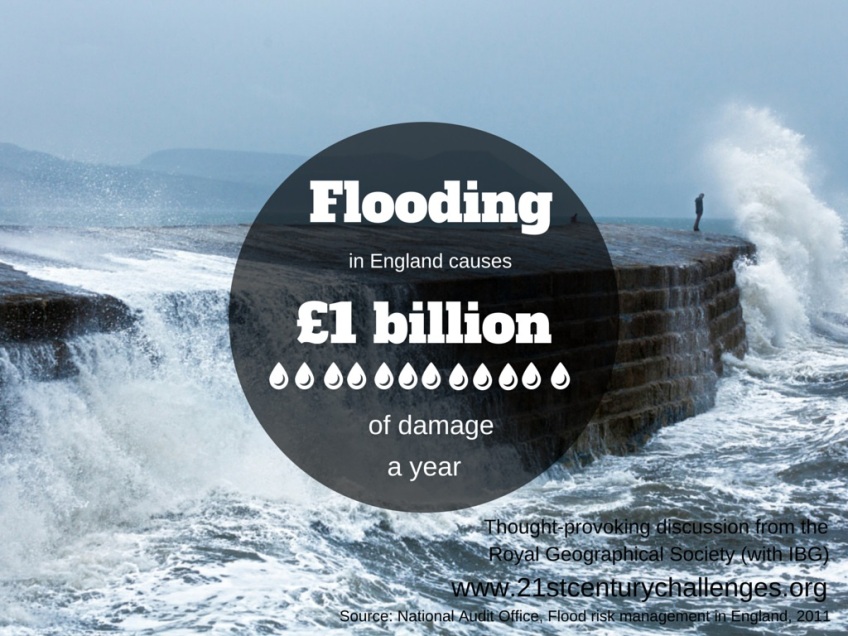
Surface water flooding occurs where high rainfall events exceed the drainage capacity in an area. Such events lead to serious flooding of property and possessions where surface water flows and collects. 3,000,000 properties are at risk from surface flooding in Enland. Surface flooding is caused by a combination of high rainfall and impervious land cover. A high amount of rainfall in a short period of time causes a fast accumulation of rain water. Impervious land cover stops the rain water from infiltrating through to the ground, therefore run off into the drainage area is rapid. Good urban planning and green space can help minimise the risk of surface water flooding.
Coastal flooding occurs when normally dry, low lying areas are inundated by sea water. In the UK this is most likely caused by sea level rise or storm surge. Coastal flooding in the UK is a natural occurence that is becoming a common problem for the UK. Management schemes and coastal defences are being put in place to mitigate and reduce the effect of coastal flooding.
The 1953 North Sea flood was the worst coastal flooding the UK has experienced. A 5m storm surge associated with a strong storm caused widespread flooding along the eastern coast of the UK, killing 309 people in England. Coastal flooding can be prevented coastal defences. There are a range of coastal defences depending upon the environment and public needs. Often multiple preventative measures are put in place to stop coastal flooding.
- Engineered defences – seawalls, levees, flood barriers
- Natural defences – gravel bars, sand dunes, salt marshes, mangroves
- Mitigation of climate change
- Flood zoning
Ways to protect homes from flood damage:
- Install non-return valves ti drainage pipes
- Use waterproof sealant on external walls and waterproof paint on internal walls
- Fit strong water-resistant doors and window frames
- Have an emergency plan and kit with essential items in case you need to evacuate
- Raise cupboard on stilts
Sea Level rise
Global sea levels are currently rising at a rate of 3.2 millimeters a year and is expected to increase by 0.8-1m by 2100. Increasing sea levels produce further land inundation of sea water and in turn coastal flooding.
Thermal expansion of ocean water as well as melting glaciers and ice sheets are the priliminary causes of sea level rise.
Thermal expansion is the increase in the volume of ocean water as a result of increased atmospheric temperature. Its contributes 1.6mm/yr to sea level rise.
Glaciers and ice sheets melting are caused by an increased atmospheric temperature. Glaciers contribute 0.77mm/yr to sea level rise, while the Greenland and Antarctic ice sheets collectively contribute 0.42mm/yr to sea level rise.
London’s flood risk
London’s flood risk
- There are over 20 main tributaries that flow into the River Thames
- 8m (26ft): the change in the water level of the River Thames. The highest and lowest tidal changes occur in the Spring
- 37: major crossings over the Thames, including 33 bridges and 4 tunnels
- 36 industrial floodgates protecting riverside industry and 380 smaller, moveable defences
- 200 miles: amount of protective walls and embankments along the Thames, some of which date back hundreds of years
- 9 counties: the number of counties the Thames runs through from source to mouth: Gloucestershire, Wiltshire, Oxfordshire, Buckinghamshire, Berkshire, Surrey, Middlesex, Kent, Essex
Read more about what is at risk if London floods?
The Thames Barrier
The Thames Barrier is a unique flood control structure on the River Thames at Woolwich Reach in East London. It is 520 meters wide and protects London against storm surges and rainfall swelling.
The barrier currently protects 125sq km (48sq miles) of London, including an estimated 1.25 million people, £200 billion worth of property and infrastructure, a large proportion of the London tube network and many historic buildings, power supplies, hospitals and schools. Without the barrier the Houses of Parliament, the O2 arena, Tower Bridge and areas of Southwark, Beckton, West Ham, Whitechapel would all be submerged in flood water.
It took eight years to build the structure, costing £535m (£1.6 billion in todays money) and became fully operational in 1982. The Thames Barrier is the second largest flood defence barrier in the world after the Oosterscheldekering Barrier in the Netherlands.
Read more about the Thames Barrier
Thames Estuary Project
The River Thames Estuary Project is a long-term management plan to protect London and surrounding areas from coastal flooding. Led by the Environmental Agency the project makes flood management plans taking into account climate change and adaptation to the Thames Barrier.
Panel discussion
The Royal Geographical Society (with IBG) held a panel discussion on 18 June 2008 to discuss the issue.
Alex Nickson, Strategy Manager for Climate Change Adaptation and Water at the Greater London Authority
Alex is developing the first Climate Change Adaptation Strategy for a world city. Alex’s role at the GLA is to raise the awareness and capacity of Londoners to respond to the impacts and opportunities of climate change. Previously, Alex worked for the Thames Gateway London Partnership (TGLP), where he was the Sustainability Manager.
“Fluvial flooding poses a threat to both affluent and poorer areas of London”.
Alex Nickson
“Risk has three components to it, probability, consequence and vulnerability.” Alex Nickson
“We are decreasing the permeability of the urban realm. An area 22 times the size of Hyde Park has been lost over concreting front gardens.” Alex Nickson
Dave Wardle, Environment Agency
Dave oversees the management of strategic projects within the estuary on:
• Thames Gateway Sustainable Development – Ensuring a quality environment is integral to the development of the estuary’s sustainable communities
• Thames Estuary 2100 – Tackling flood risk in the Thames estuary through the 21st century
• Floodscape – Exploring new approaches to flood risk management with European partners
• Olympics – Ensuring a legacy of environmental improvements
• The Thames Tideway – Finding a solution to combined sewer overflows to the Thames
Rowan Douglas, Chairman, Willis Research Network
Willis Group Limited, headquartered in London, is one of only three major risk management and insurance intermediaries that operate on a worldwide basis. The Group, together with its associates employs 12,500 people and is represented through a network of 235 offices in 73 countries.
Further Reading
Government response to 2013/14 flood, Geographical magazine, December 2014
Rising sea levels, megacities and floods, Geographical magazine, March 2015
The ‘unfairness’ of flooding, Geography Directions, 2010
2013/2014 UK Winter Floods, Geography Directions, 2014

